Exploring and Identifying Areas for Rare Earth Metal Mining using AI

Rare earth element (REE) exploration increasingly relies on remote sensing to reduce search costs, narrow field targets, and improve geological understanding before expensive drilling begins. [SciRep24] [USGS-REE] In practice, the strongest workflows do not depend on a single image or sensor; they combine multispectral mapping, hyperspectral mineral detection, structural interpretation, and GIS-based prospectivity analysis to identify the most promising areas for follow-up. [Sabins-OGR] [Schiel-S2] [UAV-HS]
1. Why remote sensing matters for REE exploration
REE deposits are geologically distinctive but often spatially small, partly buried, and difficult to recognise through field mapping alone across large regions. [USGS-REE] [UK-REE] Remote sensing helps by screening wide areas for the surface expressions of favourable host rocks, alteration patterns, geomorphic forms, and lineaments that can point to carbonatites, alkaline complexes, lateritic clay systems, or related rare-metal environments. [Sabins-OGR] [ISPRS25] [NASA-ASTER]
A central limitation is that conventional multispectral sensors usually cannot measure rare earth absorption features directly because those features are narrow and subtle. [SciRep24] [Neave-EG] For that reason, most regional workflows use multispectral imagery to map proxies such as iron oxides, clays, carbonates, weathering zones, and structural controls, then use hyperspectral data or field spectroscopy to test whether the priority zones contain REE-bearing minerals. [Neave-EG] [USGS-REE] [UAV-HS]
2. What remote sensing can detect
The exploration objective depends on scale. At regional scale, satellite imagery is most useful for distinguishing lithological units, alteration halos, regolith domains, drainage patterns, and structural corridors. [Sabins-OGR] [RS-GIS] [NASA-ASTER] At project scale, airborne and UAV hyperspectral sensors can sometimes detect mineralogical signatures associated more directly with REE-bearing phases such as bastnaesite, monazite, xenotime, parisite, synchysite, ancylite, or eudialyte. [SciRep24] [Neave-EG] [UAV-HS]
This distinction matters because "detecting a rare earth deposit" is usually an inference problem rather than a direct observation problem. [Sabins-OGR] [USGS-REE] The most reliable targets are often places where several indicators overlap: favourable geology, alteration, structural preparation, geophysical support, and either direct or indirect spectral evidence of REE-related minerals. [RS-GIS] [Balaram23] [USGS-REE]
3. Sensors and datasets
The best dataset mix depends on terrain. Arid and sparsely vegetated settings are far more favourable for spectral mapping than humid, densely vegetated, or deeply weathered regions where surface exposure is weak. [SciRep24] [Neave-EG] [UAV-HS] In tropical settings, structural mapping, regolith interpretation, and geochemical integration often become more important than direct mineral detection from space. [USGS-REE] [UK-REE]
4. A practical exploration workflow
The workflow below moves from regional screening to drill-ready targets, with AI/ML methods used at Step 4.4 to fuse the evidence layers built up in the preceding steps.
Figure 1. REE remote-sensing workflow, from regional screening to drill-ready targets. Step 4 (AI/ML integration) fuses heterogeneous evidence layers into a single ranked prospectivity surface.
4.1 Define the deposit model
An exploration programme should begin by identifying which REE deposit style is being sought, such as carbonatite-hosted deposits, alkaline complexes, or ion-adsorption clay (lateritic) systems. [USGS-REE] [UK-REE] This step determines the expected surface expressions, the most useful spectral indicators, and the kind of ancillary data needed for interpretation, and it directly shapes which case studies (see §5) are the right benchmarks. [USGS-REE] [UK-REE]
4.2 Map regional geology and structures
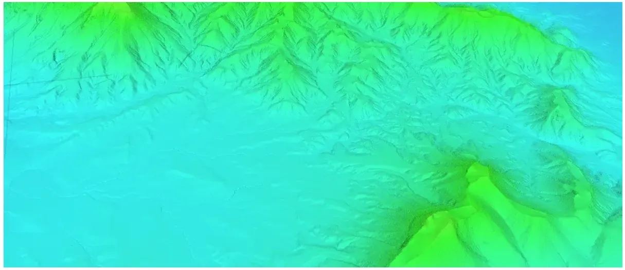
Multispectral imagery and terrain data are used to map lithological boundaries, circular intrusive patterns, faults, fracture swarms, and drainage anomalies that may indicate favourable intrusive or weathering systems. [Sabins-OGR] [ISPRS25] [NASA-ASTER] In many REE provinces, structures are critical because they localise magma emplacement, hydrothermal pathways, and regolith development. [ISPRS25] [USGS-REE]
4.3 Delineate alteration and surface mineral proxies
Band ratios, principal component analysis, and spectral indices help isolate ferric iron, Al-OH clays, Mg-OH minerals, silica-rich zones, and carbonates that commonly surround mineralised systems. [Sabins-OGR] [RS-GIS] [NASA-ASTER] In REE exploration, these are proxy indicators that narrow the search space even when the rare earth minerals themselves are below the detection threshold of multispectral sensors. [Neave-EG] [USGS-REE]
4.4 Apply AI/ML methods to integrate and prioritise targets
Once alteration, structural, and regolith layers exist, machine learning can synthesise these patterns far more effectively than manual interpretation alone. Unsupervised methods (k-means, Gaussian mixture models, self-organising maps) cluster pixels with similar spectral and topographic signatures, surfacing latent alteration or regolith domains that are not obvious from any single band ratio. [RS-GIS] [Balaram23]
Where labelled occurrences exist — known REE outcrops, geochemical anomalies, or historic showings — supervised methods (random forests, gradient-boosted trees, deep CNNs) can be trained to produce prospectivity probability surfaces. GeoAI also helps in handling missing labels through semi-supervised techniques, reconciling noisy multi-source datasets, and propagating uncertainty so downstream decisions are risk-aware. [RS-GIS] [Balaram23]
Crucially, ML compresses many heterogeneous evidence layers — Sentinel-2 ratios, ASTER mineral indices, structural lineaments from DEMs and LiDAR, radiometrics, and magnetics — into a single ranked target map. This is what makes the move from regional screening (Steps 4.2–4.3) to focused hyperspectral acquisition (Step 4.5) defensible and budgetable. [RS-GIS] [NV5-25]
4.5 Use hyperspectral data over priority targets
Once a shortlist of targets exists, hyperspectral data can test for narrow absorption features linked to Nd-bearing or other REE-bearing minerals in exposed outcrops and mine wastes. [SciRep24] [Neave-EG] This is where remote sensing becomes most powerful, because the method shifts from broad geological screening to mineral-specific spectral interpretation. [SciRep24] [UAV-HS]
Two reference spectra for monazite (a neodymium-bearing mineral) and a monazite-rich rock sample (a calcitic carbonatite from the Fen complex). The key spectral characteristic absorption bands in the VNIR range that are associated with neodymium
4.6 Integrate everything in GIS and validate in the field
Final target ranking comes from integrating image-derived layers with geophysics, radiometrics, geochemistry, and field observations in a GIS-based prospectivity model.[RS-GIS] [Balaram23] [USGS-REE] This integrated approach improves decision-making because it reduces dependence on any single imperfect indicator and highlights zones where multiple lines of evidence converge.[RS-GIS] [Balaram23]
5. Peer-reviewed examples, by deposit type
The case studies below are organised by the deposit models introduced in §4.1. Each illustrates which sensors and techniques have worked for that style of mineralisation, and where the practical limits sit.
5.1 Carbonatite-hosted: Mountain Pass, California, USA
A 2024 study in Scientific Reports demonstrated that EnMAP hyperspectral satellite data could detect neodymium-related spectral absorptions and map REE-rich rocks at Mountain Pass, one of the world’s best-known rare earth districts.[SciRep24] The significance of this work is that it showed direct satellite-based discrimination of REE-bearing materials at 30 m resolution, which is a major advance beyond indirect alteration mapping.[SciRep24]
5.2 Alkaline complex: Schiel Complex, South Africa
A study using Sentinel-2B imagery mapped potential rare earth deposits in the Schiel alkaline complex by identifying surface minerals associated with alkaline and rare-metal geology rather than detecting REEs directly. [Schiel-S2] This is a strong example of how medium-resolution multispectral imagery can still support REE exploration when the geological context is well understood and host-rock mineralogy is distinctive. [Schiel-S2]
5.3 Vein-style REE: Namibia and Finland UAV hyperspectral work
A peer-reviewed 2020 study used lightweight UAV-mounted hyperspectral sensors to detect REEs in exposed veins at Marinkas Quellen in Namibia and at Siilinjärvi in Finland.[UAV-HS] The authors reported detection of neodymium at concentrations below 200 ppm in some settings, illustrating the value of drone-based mapping for close-range target refinement and mine-scale monitoring.[UAV-HS]
5.4 Lateritic / ion-adsorption clay systems
Lateritic ion-adsorption clay deposits are a strategically important REE deposit type, but their signatures are tied to weathering patterns and regolith context rather than obvious ore minerals at the surface. That makes them a useful contrast to the carbonatite and alkaline case studies above. [USGS-REE] [UK-REE]
USGS work on rare earth deposit types highlighted the use of ASTER, Landsat 8, ALI, and Hyperion for studying lateritic clay-hosted REE environments in southern China and analogous terrains in the southeastern United States. [USGS-REE] Recent work also shows that time-series satellite imagery can detect and monitor active REE mining areas in such terrains, which provides a useful ground-truth analogue when calibrating exploration models. [REE-Mon] [Mine-Rest] For these deposit types, structural interpretation from DEMs and LiDAR, and regolith mapping from Sentinel-1/2 and ASTER, tend to outweigh direct mineral spectroscopy — which is precisely why Steps 4.2 and 4.4 of the workflow matter so much in tropical or deeply weathered settings. [USGS-REE] [UK-REE]
6. What decision-makers should watch for
The first question is not whether a sensor can "see rare earths," but whether the landscape and deposit model make surface detection plausible. [SciRep24] [Neave-EG] Exposed, arid terrains with limited vegetation are the best candidates for successful spectral targeting, while covered terrains need heavier reliance on integrated structural, geophysical, and geochemical evidence.[SciRep24] [USGS-REE] [UAV-HS]
The second question is scale. Satellite imagery is efficient for reducing a search area from thousands of square kilometres to a few prospect zones, but airborne or UAV hyperspectral surveys are usually needed to refine drill locations. [SciRep24] [Schiel-S2] [UAV-HS] This staged approach aligns well with exploration budgets because data cost rises only as geological confidence improves.[Sabins-OGR] [RS-GIS]
The third question is validation. Remote sensing can rank targets, but field spectroscopy, sampling, mineralogical analysis, and drilling are still required to confirm whether a spectral anomaly is economically meaningful. [Neave-EG] [USGS-REE] [UAV-HS] Strong programmes treat remote sensing as a decision-support layer that guides where to spend the next exploration dollar, not as a substitute for ground truth. [Sabins-OGR] [RS-GIS] [USGS-REE]
7. How AI-Metals fits into the picture
AI-Metals is an AI-first mineral exploration consultancy focused on critical minerals, including REE systems. We combine GeoAI with publicly available satellite remote sensing (Sentinel-1 SAR, Sentinel-2 optical, with Landsat and ASTER as supporting datasets) and specialised inputs (airborne and ground hyperspectral, LiDAR point clouds, plus geophysics and magnetics where the client can provide them) to produce defensible mineral prospectivity maps.
Our starting point is deliberately low-cost and low-risk: open-source remote sensing mapping is run first, to scout candidate ground before any major investment is committed. This staged approach lets clients screen large licence areas for a fraction of the cost of conventional exploration, and gives an early, geologically grounded evidence base for prioritising fieldwork — directly mirroring Steps 4.2–4.4 of the workflow above.
7.1 In-house LiDAR point-cloud processing
We process raw LiDAR returns into bare-earth DEMs, canopy-height models, and high-resolution structural derivatives — slope, curvature, openness, and multi-directional hillshade — optimised for detecting lineaments, ring structures, and fracture corridors. For lateritic and regolith-hosted REE systems in particular, this is powerful because subtle geomorphology often carries more weathering and structural information than the visible spectrum. Where vegetation cover masks the surface (e.g. tropical ion-adsorption clay terrains), LiDAR-derived bare-earth products are often the decisive layer in the prospectivity stack.
7.2 In-house hyperspectral processing and synthesis
On the hyperspectral side, we run end-to-end pipelines covering atmospheric correction, MNF-based denoising, endmember extraction, and spectral unmixing on both airborne and UAV-collected data. This includes targeted detection of Nd-related absorption features and other REE-bearing mineral signatures, applied at the spatial scales where they are physically observable. We then fuse those high-resolution mineral evidence layers with broad-area Sentinel-2 and ASTER products so that fine-grained mineral information can inform, and be informed by, regional-scale targeting.
For clients working in strategically important REE deposit types — carbonatites, alkaline complexes, ion-adsorption clays — this combination of open-source first-pass mapping and in-house hyperspectral/LiDAR refinement is well aligned with where the field is now moving, and is how we operate at the forefront of REE exploration.
8. Where the field is heading
The field is moving toward higher spectral fidelity, better signal processing, and tighter integration of remote sensing with machine learning and deposit-scale geological models. [SciRep24] [Neave-EG] [Balaram23] As hyperspectral satellite missions expand and exploration teams build larger spectral libraries for REE host minerals, remote sensing is becoming more capable of moving from indirect proxy mapping toward direct mineral detection in selected environments. [SciRep24] [Neave-EG]
For mining and policy strategy, that shift matters. Better remote targeting can shorten the time between regional screening and verified prospects, improve land-access decisions, and reduce unnecessary disturbance by focusing fieldwork on the most geologically defensible areas. [USGS-REE] [REE-Mon] [Mine-Rest]
References
Citations use compact tags throughout the text. The full sources are below.
[SciRep24] Detecting REEs using EnMAP hyperspectral satellite data — Mountain Pass, CA. Scientific Reports, 2024. Direct detection and mapping of Nd-bearing REE minerals at 30 m resolution.
[Sabins-OGR] Sabins, F.F. Remote sensing for mineral exploration. Ore Geology Reviews (classic review). Multispectral, radar, and ancillary data for lithology, alteration, and structure.
[Neave-EG] Neave, D.A. et al. On the feasibility of imaging carbonatite-hosted REE deposits using remote sensing. Economic Geology (with BAS project). Lab and airborne/spaceborne feasibility; multispectral limits.
[ISPRS25] Remote sensing technologies in the search for rare-metal mineralisation, Eastern Kazakhstan. ISPRS Archives, 2025. Structural and lithological controls; ring structures and lineaments.
[RS-GIS] Applications of remote sensing and GIS in mineral exploration. Recent review and case-study compilation on integrating satellite data, image processing, and GIS-based prospectivity modelling.
[Schiel-S2] Mapping of potential REE deposits in the Schiel Complex, South Africa. ScienceDirect peer-reviewed paper. Sentinel-2 mapping of alkaline-complex mineralogy.
[Geoimage] Identifying alteration minerals using satellite data to distinguish high-potential zones. Geoimage technical case study; practical workflows for alteration mapping.
[NV5-25] Critical minerals: renewed exploration with hyperspectral remote sensing. NV5 Geospatial white paper, 2025. Hyperspectral applications including REEs (e.g. Mountain Pass).
[Balaram23] Balaram, V. Advances in rare earth element exploration and geochemistry. Minerals, 2023 (or related review). REE occurrence, exploration methods, and analytical techniques.
[USGS-REE] USGS. Remote sensing studies of REE deposit types. ASTER, Landsat, ALI, and Hyperion applied to carbonatite-hosted, lateritic clay-hosted, and other REE deposits.
[REE-Mon] Accurate identification of REE mining area from low-resolution satellite imagery. ScienceDirect. Time-series satellite imagery for REE mining detection and monitoring (e.g. southern China).
[UAV-HS] Detection of REEs with lightweight UAV-based hyperspectral imaging. Peer-reviewed open-access, 2020. Marinkas Quellen (Namibia) and Siilinjärvi (Finland); ~200 ppm Nd thresholds.
[Mine-Rest] Mining and restoration monitoring of REE deposits. Technical/academic report on RS-based monitoring of REE mining footprints and post-mining recovery.
[UK-REE] Rare earth exploration, extraction, beneficiation, and environmental impacts. UK innovation / government technical report. REE supply chains, deposit types, environmental issues.
[NASA-ASTER] Identifying minerals using ASTER. NASA Earthdata tutorial on band combinations and spectral ranges for mapping carbonates, clays, and iron oxides.